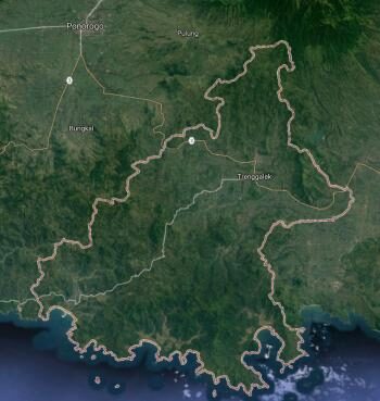
Land Use Land Cover Analysis based-on Mobile GIS: Study Case of Trenggalek Regency
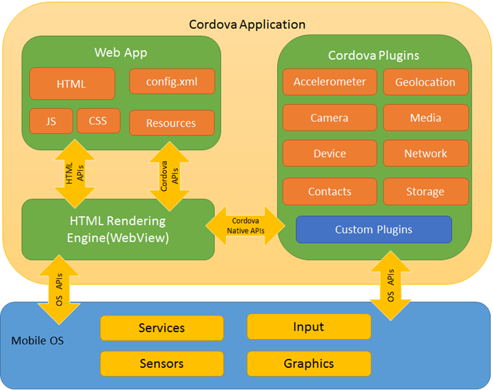
Land use and land cover is important in understanding the human activities with the environment. Trenggalek Regency with its agricultural potential is crucial to support the economy. Development in the trade industry sector is also increasing the threat to the availability of agricultural land if it is not managed properly. Endangerment of food resistance, loss of livelihood of farmers and the loss of agricultural infrastructure is an example of the impact of conversion of agricultural land into non-agricultural. The need for geographic information and updates are very important in land management and field operations. In this study a mobile GIS application will be developed for the analysis land cover and land use of Trenggalek Regency. This application is built using hybrid technology with cordova, HTML5, CSS and javascript.
This mobile GIS will help to provide information about land use and land area of the period 2014, 2015 and 2016 and also information of farmland protected area based-on Lahan Pertanian Pangan Berkelanjutan (LP2B). This study uses a semi-automatic classification plugin (SCP) is a QuantumGIS plug-in to process and classify satellite image data. Satellite imagery used include Sentinel-2 of 2016, and Landsat-8 of 2015 and 2014. Spatial data that are already classified will be exported and displayed on mobile devices android and ready to used as a reference in the field operations. With the information directly from mobile GIS, we expect the local government of Trengggalek will be easier to manage land for future development and Trenggalek people also more selective in choosing and using the land.